Venue and map
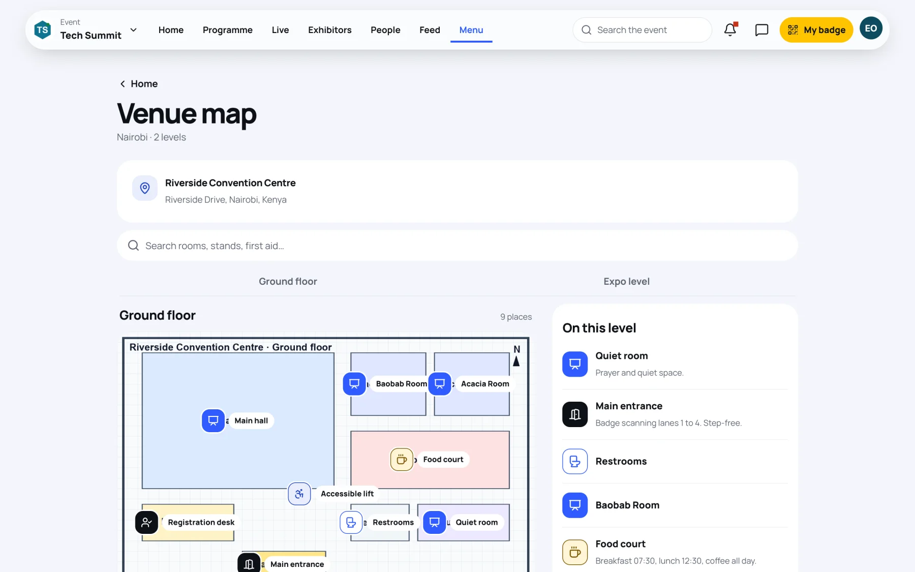
The venue map shows the floor plans the organisers have published, with every hall, stand, entrance and service marked. Use it to find your next session or the nearest toilets.
Open the map
-
Open the event, select Menu, then Venue map.
-
The top of the page shows the venue's name and address. When the organisers have added a link, select Directions to open the route in your maps app.
-
If the venue has more than one level, select a level by name, for example Ground floor or Expo level.
-
Select a point on the plan, or a place under On this level, to see what it is and any notes, such as which entrance has step-free access.
Find a place
-
Type in Search rooms, stands, first aid….
-
Select a result. The map switches to the right level and selects that place.
The search looks through every level, so you do not need to know which floor something is on.
Read the map key
Points are grouped by kind. Map key lists the kinds on the plan:
| Kind | Includes |
|---|---|
| Entrances and gates | Entrances and registration desks |
| Stages and halls | Halls and session rooms |
| Stands | Exhibitor stands |
| Catering | Food and drink |
| Accessibility and Step-free access | Lifts, ramps and step-free routes |
| First aid | First aid points |
| Toilets and services | Toilets and other facilities |
Last updated